
Building AI that understands the Gulf’s climate challenges
Monday, July 06, 2026
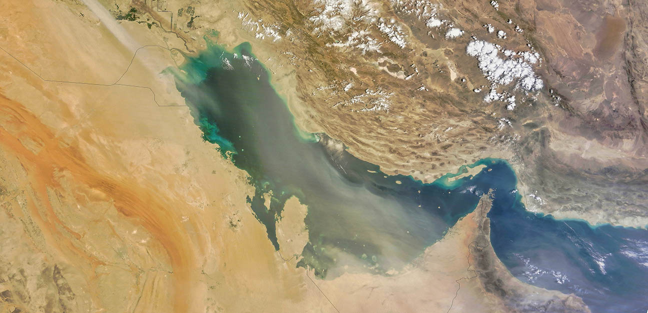
Climate action in the Gulf requires more than global models and generic summaries. The region faces a distinctive mix of climate pressures: extreme heat, dust storms, flash floods, coastal erosion, water stress, and rapid urban growth. For countries such as the UAE, Saudi Arabia, Qatar, Kuwait, Oman, and Bahrain, these risks are directly connected to infrastructure planning, public health, energy demand, water security, and long-term resilience.
A new MBZUAI-led research paper accepted to ACL Main 2026, “GCA Framework: A GCC Countries-Grounded Dataset and Agentic Pipeline for Climate Decision Support,” addresses this challenge by introducing Gulf Climate Agent (GCA), an AI framework designed specifically for climate decision support in the GCC.
The project is led by Principal Investigator Dr. Muhammad Haris Khan, with Muhammad Umer Sheikh as lead author. The team developed a framework that brings together regional climate data, policy evidence, remote-sensing inputs, and specialized analytical tools.
“Climate AI cannot be treated as one-size-fits-all,” explains Dr. Muhammad Haris Khan. “A system that supports decisions in the Gulf has to understand the region’s hazards, policies, cities, and data sources. Otherwise, it risks producing answers that are fluent but not useful.”
Climate questions are local
Large language models can answer general questions about climate change, but decisions in the Gulf often require much more specific reasoning. A planner may need to understand rainfall anomalies in a particular city, assess air-quality spikes during a dust event, compare vegetation change from satellite imagery, or interpret a national climate policy in the context of local adaptation goals.
General-purpose AI systems are not usually built for these tasks. They may lack Gulf-specific knowledge, struggle with climate visualizations, or provide responses that sound confident without being grounded in the right evidence. GCA is designed to reduce this gap by connecting user questions to climate-specific tools rather than relying only on what a model has memorized.
This is especially important for the UAE, where climate resilience is closely tied to sustainable development, infrastructure protection, clean energy, water security, and adaptation planning. A useful climate assistant must support experts working across these areas with answers that are grounded in local evidence.
A dataset built around GCC climate priorities
At the center of the framework is GCA-DS, a large multimodal dataset of about 200,000 question-answer pairs grounded in the six GCC countries. The dataset includes about 110,000 text-based examples and about 90,000 visual-temporal examples.
The textual part draws from government climate policies and adaptation strategies, NGO and international reports, academic literature, and event-based reporting on heatwaves, dust storms, and floods. The visual-temporal part uses city-level climate and environmental data from across the Gulf, supporting tasks such as anomaly detection, forecasting, imputation, and reasoning over climate variables.
“We wanted the dataset to reflect how climate work is actually done in the region,” says Muhammad Umer Sheikh. “Real decisions rarely come from one document. They require policy context, historical trends, environmental observations, and local knowledge to be considered together.”
The dataset covers topics including water resources, land and desertification, coastal and sea-level risks, air quality, health, biodiversity, energy, emissions, agriculture, urban environments, and extreme events. This breadth helps the system learn from the kinds of questions that matter most for Gulf climate planning.
Teaching the model to use tools, not just words
GCA uses an agentic pipeline. When a user asks a question, the model interprets the request, selects the right tool, receives the tool output, and then produces a grounded answer. This design helps the system move from general climate information toward practical decision support.
The tool suite includes remote sensing and land-surface analysis, air quality and atmospheric indicators, weather and rainfall analysis, hydrology, carbon-footprint estimation, geocoding, and web-based policy retrieval. In practical terms, a user could ask about vegetation change between two dates, air-quality conditions in a city, rainfall patterns during a flood event, or coastal change over time. The system is designed to route the question through the relevant analytical process rather than produce a generic explanation.
This tool-aware design is particularly relevant for the Gulf. The region’s climate challenges are highly spatial and temporal: a dust event may affect one city differently from another; a rainfall episode may create flood risk in a specific drainage system; and coastal or vegetation change may only become clear when evidence is compared across time.
Stronger performance through regional grounding
The paper shows that regional fine-tuning and tool integration improve reliability. In benchmark experiments, GCA achieved 94.2% tool selection accuracy and 88.2% end-to-end answer accuracy. Compared with the base Qwen2.5-VL 7B model, it substantially improved tool use and reduced failures such as invalid tool-call formats, incorrect arguments, and missing tool actions.
These results matter because climate AI should not be judged only by whether an answer sounds convincing. In high-stakes settings, the system must choose the right analytical path, use the correct inputs, interpret outputs accurately, and communicate findings clearly. For climate decision support, reliability depends on the full chain of reasoning and execution, not just the final paragraph.
Toward practical climate AI for the UAE and the Gulf
GCA is not presented as a replacement for climate scientists, policymakers, or domain experts. The paper notes important limitations, including partial dataset validation, dependence on upstream data sources, and the need for expert oversight in real-world use.
Its contribution is more practical: it shows how AI systems can be designed around the climate realities of a specific region. For the Gulf, this means building systems that understand local hazards, local policies, and local data needs.
As the UAE and GCC countries continue investing in climate resilience, sustainability, and AI innovation, frameworks such as GCA are helping define a new direction for climate AI: regional, multimodal, tool-aware, and built to support real decisions.
- research ,
- climate change ,
- computer vision ,
- conference ,
- ACL ,
Related

Training multimodal AI with limited labels for a world it has never seen
A new framework from MBZUAI researchers helps AI systems remain effective when data is scarce and inputs.....
Read More
Two heads are faster than one
MBZUAI researchers have developed a new approach to video understanding that reduces computational costs while maintaining accuracy.
- conference ,
- large multimodal model ,
- CVPR ,
- video ,
- research ,

The watermark as combination lock
A new system developed by MBZUAI embeds unique, key-driven watermarks into AI-generated videos, making synthetic content more.....
- watermarks ,
- CVPR ,
- conference ,
- security ,
- computer vision ,
- research ,